🎉 Up to 70% Off Selected ItemsShop Sale
Pyrenees Map 25, Anso-Hecho
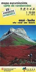
The Randonees Pyrenees numbers 20-25 are relief shaded maps based on either the Institut Cartogràfic de Catalunya or Catalan topographic survey.
Scale is 1:50k with contours at every 20m and major routes marked - including the GR11 and HRP. Features a 10-km UTM grid and small latitude and longitude margin ticks. The legend is either French and Spanish or Catalan only.
Mountain huts, refuges and campsites are shown, as are points of interest and outdoor leisure centres.
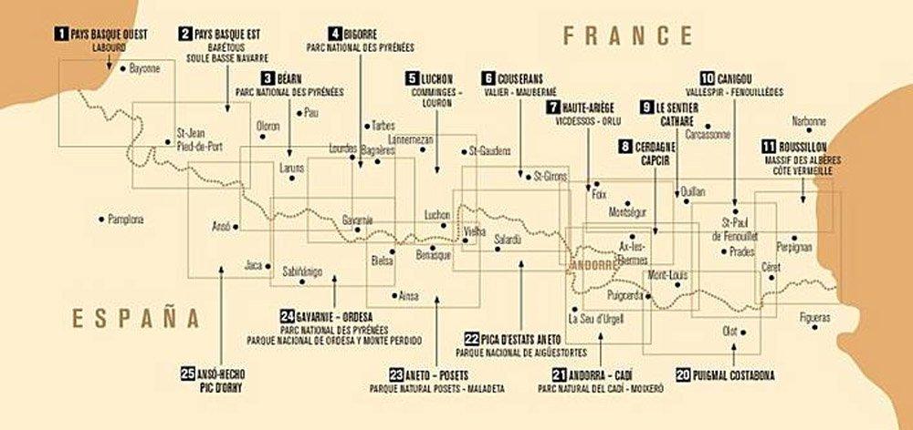
The region covered is shown in the images above.
Scale is 1:50k with contours at every 20m and major routes marked - including the GR11 and HRP. Features a 10-km UTM grid and small latitude and longitude margin ticks. The legend is either French and Spanish or Catalan only.
Mountain huts, refuges and campsites are shown, as are points of interest and outdoor leisure centres.
The region covered is shown in the images above.
$10.99
Pyrenees Map 25, Anso-Hecho—
$10.99
Description
The Randonees Pyrenees numbers 20-25 are relief shaded maps based on either the Institut Cartogràfic de Catalunya or Catalan topographic survey.
Scale is 1:50k with contours at every 20m and major routes marked - including the GR11 and HRP. Features a 10-km UTM grid and small latitude and longitude margin ticks. The legend is either French and Spanish or Catalan only.
Mountain huts, refuges and campsites are shown, as are points of interest and outdoor leisure centres.
The region covered is shown in the images above.