🎉 Up to 70% Off Selected ItemsShop Sale
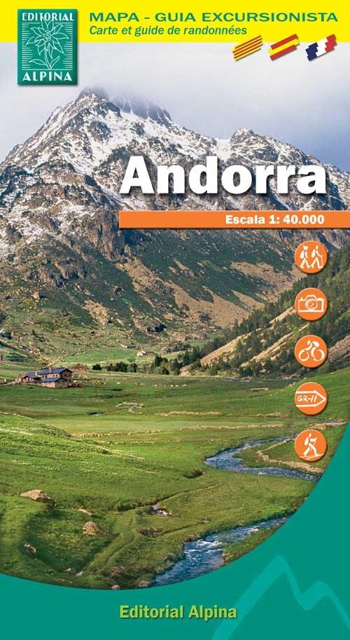
Andorra
Editorial Alpina produce an extensive range of walking maps covering key hiking areas of Spain.
The maps are contoured at 10 and 20 m intervals and feature hill shading and summit heights. All maps also feature long distance footpaths and hiking trails, campsites and camping huts. Each title has a separate booklet with general information on the area, descriptions of selected hiking routes, a list of accommodation with addresses, etc. and is presented in a plastic wallet.
The maps are contoured at 10 and 20 m intervals and feature hill shading and summit heights. All maps also feature long distance footpaths and hiking trails, campsites and camping huts. Each title has a separate booklet with general information on the area, descriptions of selected hiking routes, a list of accommodation with addresses, etc. and is presented in a plastic wallet.
- Legend in English
- Scale 1/40,000
- Coverage: Peaks- Pic de la Serrera, Pic de Font Blaca, Pic de Comapedrosa; GR11; GR7; Andorra la Vella
- ISBN 9788480904414
- GPS compatible
$12.50
Andorra—
$12.50
Description
Editorial Alpina produce an extensive range of walking maps covering key hiking areas of Spain.
The maps are contoured at 10 and 20 m intervals and feature hill shading and summit heights. All maps also feature long distance footpaths and hiking trails, campsites and camping huts. Each title has a separate booklet with general information on the area, descriptions of selected hiking routes, a list of accommodation with addresses, etc. and is presented in a plastic wallet.
The maps are contoured at 10 and 20 m intervals and feature hill shading and summit heights. All maps also feature long distance footpaths and hiking trails, campsites and camping huts. Each title has a separate booklet with general information on the area, descriptions of selected hiking routes, a list of accommodation with addresses, etc. and is presented in a plastic wallet.
- Legend in English
- Scale 1/40,000
- Coverage: Peaks- Pic de la Serrera, Pic de Font Blaca, Pic de Comapedrosa; GR11; GR7; Andorra la Vella
- ISBN 9788480904414
- GPS compatible